A central Wisconsin levee south of Highway 33 was failing Sunday and leaking water cut off access into a park near Portage, officials said as they assessed damage from floods and prepared for more in the upper Midwest.
It wasn't immediately clear how many of the roughly 300 residents remained in Blackhawk Park around 4 p.m. Sunday when the road was closed following the failure of the Caledonia Levee south of Highway 33.
The Columbia County Emergency Management Office was letting nobody in or out of the park until further notice and warned all morning that emergency vehicles, including police, fire and ambulances, would not be able to reach any residents who stayed behind.
Kathy Johnson, deputy director of the Columbia County Emergency Management Office, told The Associated Press that in the event of an emergency, "people are going to have to come out by boat."
"The residents down there are used to having high water and dealing with high water a lot but this could be something that they've never seen, with this amount of water," Johnson said.
She said those who evacuated might be out of their homes for up to a week.
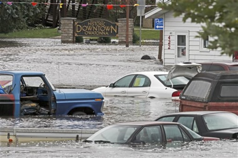
In Zumbro Falls, Minn., floodwaters destroyed 58 homes and 20 businesses, said NBC affiliate KARE-TV of Minneapolis.
Gov. Tim Pawlenty toured flood-devastated areas in southeastern Minnesota's Zumbro River Valley on Sunday afternoon and assured residents that aid will be forthcoming, the Minneapolis Star Tribune reported. It said other parts of the state, especially those on the Minnesota River, braced for flooding.
In Wabasha County, where the Zumbro River flows, and Blue Earth, where the Minnesota flooded, many roads were closed.
Tracy Yennie, who lives just outside Zumbro Falls, was able to take a four-wheeler to her home to see the destruction. Crying, she said, "It's devastating. We lost everything, everything, kids clothes, baby pictures, everything. It's scary."
She said, "There's no road left in front of the house. The basement wall collapsed in on everything and the house is a total loss."
The floods resulted from a slow march of thunderstorms across southern Minnesota through central Wisconsin from Wednesday through Friday. The storms dumped several inches of rain across the region. Storm totals between 5 and 7 inches were common, with 10.86 inches at Amboy in south-central Minnesota. The governors of both states declared states of emergency.
The National Weather Service’s Advanced Hydrologic Prediction Service said the Wisconsin River had reached 20.18 feet in Portage near the Highway 33 bridge, the Wisconsin State Journal newspaper reported. That is also the predicted crest, it said.
In St. Clair, Minn., the LeSueur River kept rising long after rains had stopped.
The Minnesota National Guard said it had 134 soldiers on flood duty across the southern part of the state.
Elsewhere in Wisconsin, water levels were receding in many areas, and officials began documenting damage. Some roads remained washed out.
Emergency management officials said at least 10 homes in Stevens Point remained evacuated Sunday. Officials in Sauk County were suggesting that residents in low lying areas along the Wisconsin River evacuate.
Emergency management officials say they'll continue to monitor river levels in southern Minnesota. Areas of concern for the coming week include the Minnesota River in Scott and Carver counties and the Mississippi River at St. Paul and Hastings.

Elsewhere, in the small South Dakota town of Renner, just north of Sioux Falls, sandbags were being filled to deal with any unexpected rise of the Big Sioux River.
Officials said about 10,000 sandbags had been placed and another 10,000 would be filled and stockpiled.
The National Weather Service expects the river to crest Monday morning about 4 feet over flood stage.
The Big Sioux River has been running high all summer. Heavy rain last week pushed the river over its banks from Brookings south to Sioux Falls.
